
Dale Street, Chatham
In this article Helen Counsell remembers her childhood living in Dale Street, Chatham.
Kent Maps Online is an open access, Digital Heritage project developed by Canterbury Christ Church University in collaboration with JSTOR Labs. Our aim is to start new conversations between researchers across all disciplines, with a shared interest in the history of Kent.
Entries draw on a range of archival sources including: maps, pictures and postcards, manuscript records and newspapers. Click on the pin or image icons to view historic maps or pictures integrated into each article.
The site is fully searchable, with hyperlinks on each page, to help you find your own answers to questions you haven’t thought of yet.
In this article Helen Counsell remembers her childhood living in Dale Street, Chatham.

A suffragette attack on the Nevill Ground Cricket Pavilion at Tunbridge Wells shocked pre-war kent as women challenged their subjugated roles in society and their invisibility in sport.

Like most families of nobility during the early modern period, the Cheynes could trace their lineage back to the Norman Conquest. Thomas Cheyne was born c. 1485, the son of William de Cheyne and Ma...

A neurodivergent perspective of visiting Herne Bay

The arrival of Christianity in England

In this article Helen Counsell remembers her time at Fort Pitt Grammar School in the late 1970s and early 1980s, and looks back at the history of the school site.

An article about Douglas Morey Ford's 1910 novel The Raid of Dover written for Dover at Night 2026.

Tree roundels of stately oaks grace the landscape south of Canterbury.
Romney Marsh prompts a particular kind of watchfulness, something close to unease. It is the perfect setting for literary crime.

Landscape art around Canterbury Cathedral charts a shift from idealized seventeenth-century panoramas to nineteenth-century pastoral and picturesque scenes that fold piety, power, and leisure into views of fields, rivers, and sky. Engravings and paintings by Hollar, the Buck brothers, Palmer, and others show how patronage, Anglican authority, and new mobility such as the railway reshaped what the cathedral meant within its rural setting.

Cooper’s Pit in Wincheap, Canterbury preserves a rare inland chalk exposure that links Cretaceous marine fossils, flint bands, and later Thanet Sand instability to modern risks such as sinkholes and runoff-driven cliff collapse. Nineteenth- and twentieth-century lime quarrying and rail-linked kilns reshaped the site, and post-1975 closure left an overgrown industrial landscape now pressured by nearby housing development.
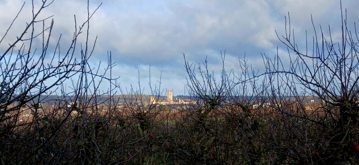
Canterbury Cathedral’s towers shape how people read the surrounding hills, orchards, water meadows, and suburbs from the medieval period to the present. Early modern and modern maps, along with accounts of paths, agriculture, and industry, reveal how cartography and viewpoint privilege civic power while obscuring lived routes, labour, and contested land. The shrinking orchard belt and threatened sightlines show the cathedral’s visual dominance as an environmental and heritage problem as much as an architectural one.